
All atolls
Showing all 10




Side by side, nearest first.
Distance is the straight line from Velana International Airport, computed from each atoll's coordinates. The transfer column is the usual one for that range; resorts set their own, so confirm when booking.
Atoll organisation
Atolls and codes Transfers by distance.
The Maldives is made up of natural atolls grouped into administrative atolls, each with a Dhivehi name and a letter code. How you reach an island depends on its distance from Velana International Airport.
01
Natural and administrative atolls
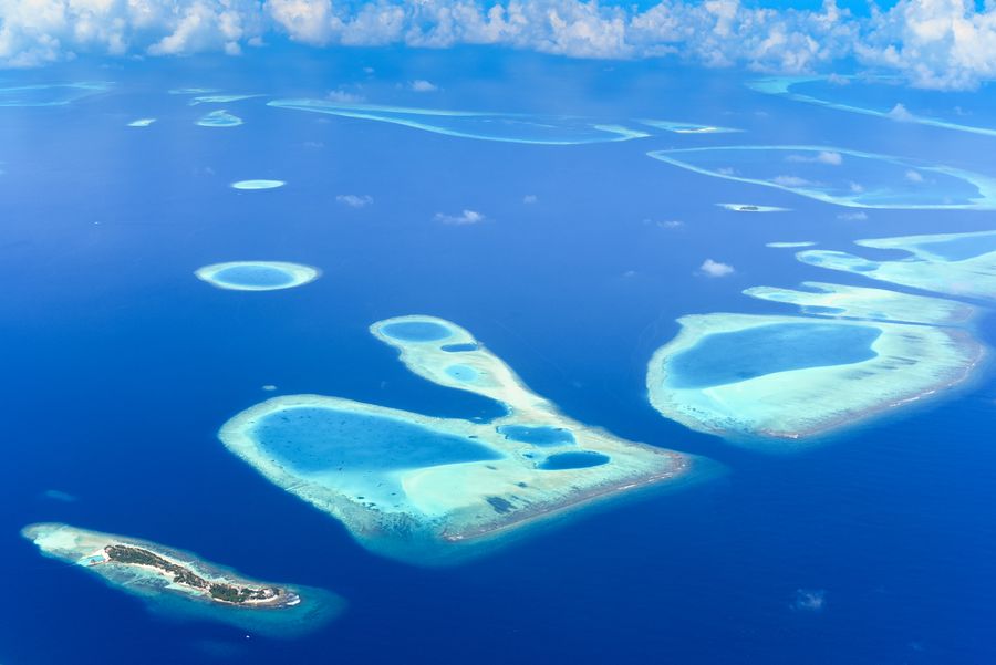
A natural atoll is a ring of coral reef and sand cays formed over a long period. The Maldives has many natural atolls, but for government purposes they are grouped into administrative atolls, which may combine several natural atolls or split one. Each administrative atoll has a Dhivehi name and a letter code used on signs and ferry boards, such as H for Kaafu, which covers North and South Malé.
The letter codes are practical. They appear on island signs, ferry timetables and official documents. Knowing the code helps when reading a timetable or asking for directions. The Dhivehi name is used in everyday speech and on maps. Both refer to the same administrative area, so you may see either on your journey.
02
Distance decides the transfer
Velana International Airport sits on Hulhulé island beside Malé. The seaplane terminal is on the same airport island. For islands close to the airport, such as those in Kaafu, a speedboat is usual. Speedboats can run day and night, so they suit arrivals at any hour. Seaplanes fly in daylight only, so an arrival after dark may mean an overnight in Malé or Hulhumalé.
For islands further away, a scheduled domestic flight to a regional airport is often the first leg. Domestic flights reach airports including Dharavandhoo in Baa, Maamigili in South Ari, Ifuru in Raa, Kadhdhoo in Laamu and Gan in Addu, which also has international flights. A boat transfer usually follows the flight. The choice between seaplane and domestic flight depends on the atoll and the time of day.
03
Resort and inhabited islands
Resort islands are private, one island one resort, and alcohol is served. Transfers are arranged by the resort. Inhabited islands have villages, guesthouses, mosques, schools and harbours. They are dry, so no alcohol is available. Swimwear is allowed only on designated beaches, often called bikini beaches, and shoulders and knees should be covered in the village. During Ramadan, eating and drinking in public in daylight is avoided.
Both types of island are spread across the atolls. Some atolls have many resorts, others have more inhabited islands. The list and table on this page show atolls with their codes and the main transfer options. The cards give a summary of each atoll, but the details of resorts and guesthouses are not listed here. For specific islands, check the individual atoll pages or ask the resort or guesthouse.
04
Reading the list and table
The list on this page groups atolls by code and name. Each entry links to a page with more detail. The table summarises the main transfer options for each atoll: speedboat, seaplane or domestic flight. The table is a guide only. Transfer times and availability change with the season and with demand, so always confirm with the resort or guesthouse before booking.
When using the table, note that the transfer type is determined by distance from Velana and by the time of day. Seaplanes operate in daylight, while speedboats can run at night. Domestic flights follow scheduled timetables. The table does not give prices or durations, as these vary. For current information, check with the resort, guesthouse or the official source.
Questions people ask.
What is the difference between a natural atoll and an administrative atoll in the Maldives?
A natural atoll is a physical ring of coral reef and sand cays. An administrative atoll is a government division that may group several natural atolls or split one. Each administrative atoll has a Dhivehi name and a letter code, such as H for Kaafu. The codes appear on signs and ferry boards.
How do I know which transfer type my island uses?
The transfer type depends mainly on distance from Velana International Airport. Islands close to the airport, such as in Kaafu, usually use speedboats. Further islands may use seaplanes or domestic flights followed by a boat. The table on this page gives a guide, but always confirm with the resort or guesthouse.
Why do seaplanes only fly in daylight?
Seaplanes in the Maldives operate under visual flight rules and are not equipped for night flying. They also need to land on water, which requires daylight for safety. Speedboats can run day and night, so they are used for late arrivals. If you arrive after dark, you may need to overnight near the airport.
Which atolls have domestic airports?
Scheduled domestic flights reach regional airports including Dharavandhoo in Baa, Maamigili in South Ari, Ifuru in Raa, Kadhdhoo in Laamu and Gan in Addu. Gan also has international flights. A boat transfer usually follows the flight to reach the final island. Timetables change, so check with the resort or guesthouse.
Can I stay on an inhabited island in any atoll?
Guesthouses on inhabited islands are found in many atolls, but not all. Some atolls have more guesthouses than others. Inhabited islands have villages and no alcohol, and swimwear is limited to designated beaches. Check the individual atoll pages or ask the guesthouse for current options.
How do I read the letter codes on island signs?
The letter codes are administrative atoll codes. For example, H is Kaafu, which covers North and South Malé. The code is often followed by a Dhivehi name. The same code appears on ferry boards and timetables. Knowing the code helps when asking for directions or reading schedules.
Do transfer times and availability change?
Yes, transfer times and availability can change with the season, weather and demand. Seaplanes and domestic flights have set schedules, while speedboats may be arranged on request. The table on this page is a guide only. Always confirm with the resort, guesthouse or the official source before you travel.